Amouli (Āmouli)
Āmouli is a village on the southeast coast of Tutuila Island, American Samoa at the narrowest point of the island. It is located to the west of 'Au'asi, immediately to the south of 'Aoa on the north coast. It was home to 920 residents at the 2010 U.S. Census, all of which were Pacific Islanders by race. It is located in Sa'Ole County.
A larger shipwreck is located right beside the road in Āmouli. Locals say the vessel ran aground with a full load of fish, and when it overturned, it spilled its cargo within reach of villagers to gather it.
Dr. Charles Fletcher of the University of Hawaiʻi at Mānoa has conducted a sea level study of Āmouli village. He was the keynote speaker at American Samoa's first climate change summit in 2011, where he revealed that land in the village near the sea could be covered by water within ten years.
Map - Amouli (Āmouli)
Map
Country - American_Samoa
 |
 |
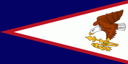
American Samoa consists of five main islands and two coral atolls; the largest and most populous island is Tutuila, with the Manuʻa Islands, Rose Atoll and Swains Island also included in the territory. All islands except for Swains Island are part of the Samoan Islands, The total land area is 199 sqkm, slightly more than Washington, D.C. As of 2022, the population of American Samoa is approximately 45,443 people, of whom the vast majority are indigenous ethnic Samoans. Most American Samoans are bilingual and can speak English and Samoan fluently.
Currency / Language
| ISO | Currency | Symbol | Significant figures |
|---|---|---|---|
| USD | United States dollar | $ | 2 |
| ISO | Language |
|---|---|
| EN | English language |
| SM | Samoan language |
| TO | Tongan language |


